Recent Posts
Monthly Archive
- May, 2014 (1)
- February, 2014 (3)
- February, 2013 (3)
- January, 2013 (3)
- December, 2012 (1)
- September, 2012 (1)
- April, 2012 (1)
- February, 2012 (2)
- October, 2011 (1)
Forest Fire Mapping and Modelling in the Sathyamangalam landscape
In February 2012, the Tamil Nadu Forest Department invited the Asian Nature Conservation Foundation (ANCF) to participate in, and guide a study on forest fire mapping and modelling in the Sathyamangalam Wildlife Sanctuary in the southern Indian state of Tamil Nadu.
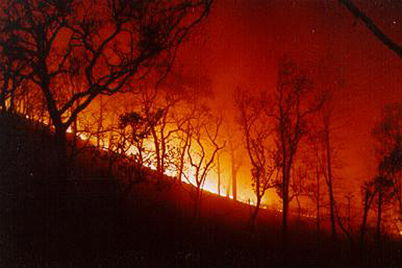
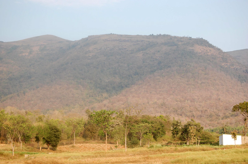
The Sathyamangalam landscape, a crucial connecting link between the Western and Eastern Ghats, is home to large tracts of tropical deciduous forests and tropical dry thorn forests. At higher elevations tropical high elevation evergreen forests and grasslands are also distributed. Patches of evergreen forests are also distributed in moist areas of the wildlife sanctuary. Forest fires are almost annual disturbances in this landscape, however very little is known about the forest fire regime and its ecological effects. As a first step we propose to identify areas in the landscape vulnerable to frequent fires.
Forest fire risk zonation mapping for the entire forest area is a prerequisite for preparing forest fire management plans. Such zonation can be done by taking various factors that are influencing fire into consideration, which include, the fuels, the topography, the proximity to villages/roads, and environmental factors in the landscape. These maps are useful in delineating areas from most to least vulnerable to fire, and helpful for creating fire lines and combating fire hazards.
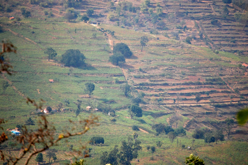
Several villages and human settlements are situated within the landscape. Humans continue to depend on forests for a variety of uses such as cattle grazing, collection of fuel wood, and collection of non-timber forest products. Fire is frequently used as a tool to burn agricultural debris and to clear agricultural fields during the fallow period. The human dimensions of fire use are important in studying forest fires in the landscape.
Some relevant publications
Kodandapani, N. 2001. Forest Fires: Origins and ecological paradoxes. Resonance. 6(11):34-41.
Kodandapani, N., Mark A. Cochrane and Sukumar, R. 2004. Conservation threat of Increasing fire frequencies in the Western Ghats, India. Conservation Biology. 18(6):1553-1561.
Kodandapani, N., Mark, A. Cochrane and Sukumar, R. 2008. A comparative analysis of spatial, temporal, and ecological characteristics of forest fires in a seasonally dry tropical ecosystem in the Western Ghats, India. Forest Ecology and Management. 256: 607-617.
Renard, Q., Pélissier, R., Ramesh, B.R., Kodandapani, N. 2012. Environmental susceptibility models to predict wildfire occurrences in the Western Ghats of India. International Journal of Wildland Fire.

A forest fire raging in a tropical deciduous forest.

An overview of the Sathyamangalam landscape showing cultivation and human presence.

Tropical deciduous forests of the Sathyamangalam landscape.


Post new comment